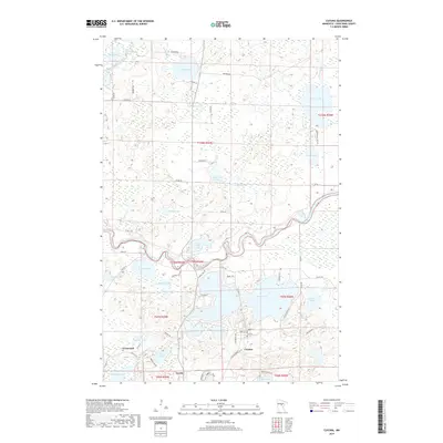
2019 Map of Cuyuna
USGS Topo · Published 2019About this map
The Mississippi River meanders across the central portion of this landscape, defining the northern boundaries of Crosby and Cuyuna. This region in Crow Wing County is characterized by an intricate network of glacial lakes and wetlands, including Rabbit Lake, Dean Lake, and Perry Lake. The settlement patterns here are closely tied to the water, with the small communities of Trommald and Cuyuna situated near the complex hydrology of the Rabbit River and Lake Cuyuna.
Find a feature on this map
60 named features on this map. Tap any name to fly to it.
Don’t see what you’re looking for? This feature index may not catch every label — zoom into the map to look around manually.
Map Details
Editions of this 2019 Cuyuna Map
This is the sole edition of this map. No revisions or reprints were ever made.
Other maps of this area

1912 · Deerwood
USGS Topo · 1:62,500

1913 · Cuyuna
USGS Topo · 1:62,500

1914 · Deerwood
USGS Topo · 1:62,500

1915 · Cuyuna
USGS Topo · 1:62,500

1915 · Brainerd
USGS Topo · 1:62,500

1918 · Brainerd
USGS Topo · 1:62,500

1953 · Duluth
USGS Topo · 1:250,000

1953 · Brainerd
USGS Topo · 1:250,000

1957 · Brainerd
USGS Topo · 1:250,000

1958 · Brainerd
USGS Topo · 1:250,000