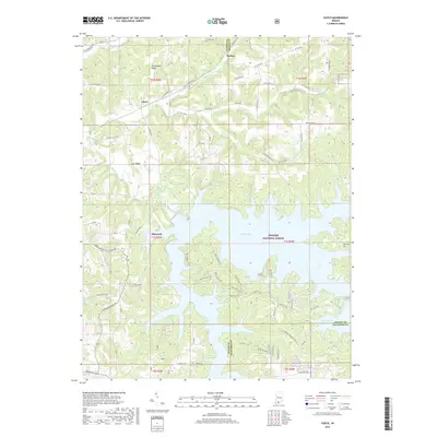
2019 Map of Cuzco
USGS Topo · Published 2019About this map
Patoka Lake dominates this Southern Indiana landscape, its intricate, branching fingers reaching into the southern half of the quadrangle. Established within the Hoosier National Forest, the lake area is marked by recreational infrastructure including the E Lick Fork Marina and an extensive network of the Main Hiking Trail and Bicycle Trail. North of the water, the terrain transitions into a series of ridges and valleys, featuring Persimmon Ridge and Lost Ridge. Small settlements like Cuzco, Ellsworth, and Norton are connected by a grid of rural routes such as E Cuzco Rd N and E Dubois Cuzco Rd. The persistence of local heritage is visible at the Swift Cem near the Orange County border, providing a clear view of the area's geography following the 20th-century creation of the reservoir.
Find a feature on this map
55 named features on this map. Tap any name to fly to it.
Don’t see what you’re looking for? This feature index may not catch every label — zoom into the map to look around manually.
Map Details
Editions of this 2019 Cuzco Map
This is the sole edition of this map. No revisions or reprints were ever made.
Other maps of this area

1951 · Hillham
USGS Topo · 1:24,000

1951 · French Lick
USGS Topo · 1:24,000

1954 · Dubois
USGS Topo · 1:24,000

1955 · Saint Anthony
USGS Topo · 1:24,000

1956 · Greenbrier
USGS Topo · 1:24,000

1956 · Taswell
USGS Topo · 1:24,000

1956 · Rusk
USGS Topo · 1:24,000

1956 · Vincennes
USGS Topo · 1:250,000

1957 · Vincennes
USGS Topo · 1:250,000

1957 · Cuzco
USGS Topo · 1:24,000