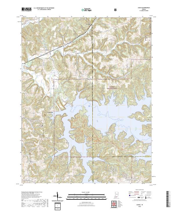
2022 Map of Cuzco
USGS Topo · Published 2022About this map
Patoka Lake dominates this 2022 survey of southern Indiana, its intricate, branching fingers reaching into the surrounding Hoosier National Forest. The landscape is defined by the transition from the winding Patoka River to this massive reservoir, which has reshaped the local geography. Small settlements like Cuzco and Norton remain situated along the northern ridges, while Ellsworth sits near the lake's western edge. The terrain is marked by significant landforms such as Persimmon Ridge and Lost Ridge, which dictate the winding paths of rural roads like E Cuzco-Norton Rd. For those interested in the area's recreational development, the map details modern infrastructure such as the E Lick Fork Marina and an extensive network of recreation paths, including the Bicycle Trl and Main Hiking Trl, which weave through the wooded hillsides of the national forest.
Find a feature on this map
46 named features on this map. Tap any name to fly to it.
Don’t see what you’re looking for? This feature index may not catch every label — zoom into the map to look around manually.
Map Details
Editions of this 2022 Cuzco Map
This is the sole edition of this map. No revisions or reprints were ever made.
Other maps of this area

1951 · Hillham
USGS Topo · 1:24,000

1951 · French Lick
USGS Topo · 1:24,000

1954 · Dubois
USGS Topo · 1:24,000

1955 · Saint Anthony
USGS Topo · 1:24,000

1956 · Greenbrier
USGS Topo · 1:24,000

1956 · Taswell
USGS Topo · 1:24,000

1956 · Rusk
USGS Topo · 1:24,000

1956 · Vincennes
USGS Topo · 1:250,000

1957 · Vincennes
USGS Topo · 1:250,000

1957 · Cuzco
USGS Topo · 1:24,000