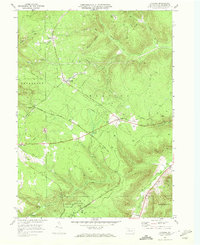
1969 Map of Cyclone
USGS Topo · Published 1972About this map
Bradford Oil Wells and gas operations dominate this McKean County landscape during the late 1960s, illustrating the region's long-standing industrial character. The map documents a complex network of resource extraction, from the clustered Strip Mines south of Mount Alton to the numerous oil and gas wells scattered across the dissected plateau. Transportation history is deeply etched into the terrain, visible in the Baltimore and Ohio Railroad Grade and an Old Railroad Grade that winds through the steep valleys.
Find a feature on this map
37 named features on this map. Tap any name to fly to it.
Don’t see what you’re looking for? This feature index may not catch every label — zoom into the map to look around manually.
Map Details
Editions of this 1969 Cyclone Map
2 editions found
Other maps of this area

1924 · Bradford
USGS Topo · 1:62,500

1926 · Bradford
USGS Topo · 1:62,500

1933 · Smethport
USGS Topo · 1:62,500

1935 · Mt. Jewett
USGS Topo · 1:48,000

1937 · Smethport
USGS Topo · 1:62,500

1940 · Mt. Jewett
USGS Topo · 1:62,500

1941 · Bradford
USGS Topo · 1:62,500

1944 · Bradford
USGS Topo · 1:62,500

1948 · Crosby
USGS Topo · 1:62,500
1948 · Crosby
USGS Topo · 1:24,000
Featured Places
- Lafayette Township, PA
- McKean, Keating Township
- Bingham, Lafayette Township
- Wolf Run, Keating Township
- Gaffney, Hamlin Township