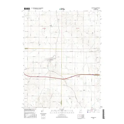
2016 Map of Cynthiana
USGS Topo · Published 2016About this map
The town of Cynthiana sits at the junction of several key county roads, serving as a central hub in a landscape defined by its agricultural grid and complex water network. Small settlements like Mounts to the north and Nisbet to the south anchor the local geography, connected by routes such as W State Rd 68 and Co Rd 950 N. The terrain is drained by several significant waterways, including the Black River and Big Creek, alongside engineered drainage systems like the Newman Lateral and McGary Ditch. This 2016 survey illustrates how modern infrastructure, such as the Hepler Airport, coexists with the area's deep-rooted pioneer history. Numerous family and community burial grounds, including Knowles Cem and Mount Mariah Cem, are scattered across the quadrangle, providing critical markers for genealogists tracing families within the overlapping boundaries of Gibson, Posey, and Vanderburgh counties.
Find a feature on this map
63 named features on this map. Tap any name to fly to it.
Don’t see what you’re looking for? This feature index may not catch every label — zoom into the map to look around manually.
Map Details
Editions of this 2016 Cynthiana Map
This is the sole edition of this map. No revisions or reprints were ever made.
Other maps of this area

1901 · Princeton
USGS Topo · 1:62,500

1901 · Haubstadt
USGS Topo · 1:62,500

1903 · Haubstadt
USGS Topo · 1:62,500

1903 · New Harmony
USGS Topo · 1:62,500

1903 · Princeton
USGS Topo · 1:62,500

1903 · Patoka
USGS Topo · 1:125,000

1904 · Mount Carmel
USGS Topo · 1:62,500

1938 · New Harmony
USGS Topo · 1:62,500

1956 · Vincennes
USGS Topo · 1:250,000

1957 · Vincennes
USGS Topo · 1:250,000