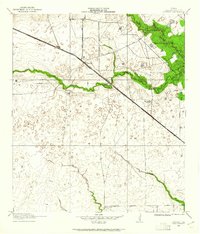
1915 Map of Cypress
USGS Topo · Published 1961About this map
Cypress sits at the intersection of early twentieth-century rail and road networks in Harris County, where the Houston and Texas Central railroad cuts a diagonal line across the landscape. The area is defined by its riparian corridors, with Cypress Creek and its tributaries, including Langham Creek and Horsepen Creek, shaping the terrain. This 1915 survey shows a rural community supported by local institutions like the Big Cypress School and Brink School. A notable landmark of the era is the Houston Hot Wells, reflecting the local utilization of mineral waters. Further north, the Cypress Gun Club and Bams Ranch illustrate the varied land use of the period, from private estates to recreational grounds. The network of thoroughfares, such as Rose Hill Road and Spring Road, provided essential connections for the scattered homesteads and small settlements before the region's mid-century expansion.
Find a feature on this map
14 named features on this map. Tap any name to fly to it.
Don’t see what you’re looking for? This feature index may not catch every label — zoom into the map to look around manually.
Map Details
Editions of this 1915 Cypress Map
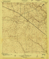
3 editions found
Other maps of this area

1915 · Cypress
USGS Topo · 1:24,000

1915 · Katy
USGS Topo · 1:24,000

1915 · Addicks
USGS Topo · 1:24,000

1915 · Hillendahl
USGS Topo · 1:24,000

1916 · Rose Hill
USGS Topo · 1:24,000

1916 · Louetta
USGS Topo · 1:24,000

1916 · Hockley
USGS Topo · 1:24,000

1916 · Satsuma
USGS Topo · 1:24,000

1916 · Swanson
USGS Topo · 1:24,000

1918 · Cypress
USGS Topo · 1:31,680