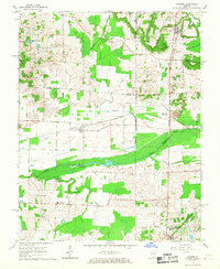
1966 Map of Cypress
USGS Topo · Published 1967About this map
Cypress Creek Bottoms and the broad marshes of the Cache River define this southern Illinois landscape at the intersection of Union, Johnson, and Pulaski Counties. In the mid-1960s, the Chicago and Eastern Illinois railroad serves as the primary industrial artery, connecting rural settlements like Cypress and Perks. The map captures specialized local industry through the presence of Charcoal Ovens near the railroad tracks and Limekiln Springs to the south.
Find a feature on this map
32 named features on this map. Tap any name to fly to it.
Don’t see what you’re looking for? This feature index may not catch every label — zoom into the map to look around manually.
Map Details
Editions of this 1966 Cypress Map
This is the sole edition of this map. No revisions or reprints were ever made.
Other maps of this area

1918 · Vienna
USGS Topo · 1:62,500

1919 · Vienna
USGS Topo · 1:62,500

1920 · Dongola
USGS Topo · 1:62,500

1923 · Dongola
USGS Topo · 1:62,500

1928 · La Center
USGS Topo · 1:62,500

1931 · Cairo
USGS Topo · 1:62,500

1932 · La Center
USGS Topo · 1:62,500

1933 · Cairo
USGS Topo · 1:62,500

1939 · Cairo
USGS Topo · 1:62,500

1942 · Vienna
USGS Topo · 1:62,500