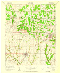
1956 Map of Cyril
USGS Topo · Published 1959About this map
The Cyril and Cement area of Caddo County is defined by its mid-century petroleum infrastructure, prominently featuring the expansive North Cement Oil and Gas Field and South Cement Oil and Gas Field. The industrial character of the landscape is punctuated by an Oil Refinery at Cyril and several support structures including a Powerhouse, Central powerhouse, and Pump house. These sites reflect the intensive resource extraction that shaped the local economy and settlement patterns during the 1950s.
Find a feature on this map
16 named features on this map. Tap any name to fly to it.
Don’t see what you’re looking for? This feature index may not catch every label — zoom into the map to look around manually.
Map Details
Editions of this 1956 Cyril Map
2 editions found
Other maps of this area

1945 · Anadarko
USGS Topo · 1:62,500

1949 · Cement
USGS Topo · 1:62,500

1949 · Elgin
USGS Topo · 1:24,000

1951 · Fort Cobb
USGS Topo · 1:62,500

1955 · Lawton
USGS Topo · 1:250,000

1955 · Clinton
USGS Topo · 1:250,000

1956 · Laverty
USGS Topo · 1:24,000

1956 · Fletcher
USGS Topo · 1:24,000
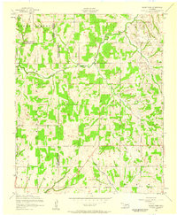
1956 · Rocky Ford
USGS Topo · 1:24,000

1956 · Elgin
USGS Topo · 1:24,000