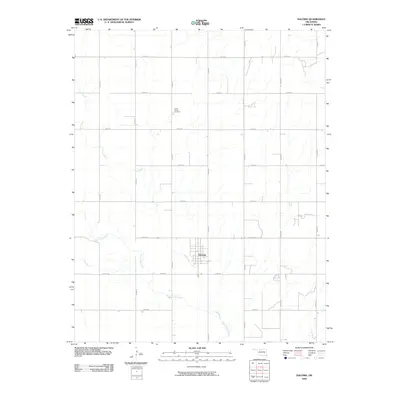
2009 Map of Dacoma
USGS Topo · Published 2009About this map
Dacoma serves as the central hub of this northern Oklahoma agricultural region, situated at the confluence of several section-line roads and the local waterway Lake Creek. The town's grid is small and orderly, surrounded by expansive rural sections that highlight the late 20th-century land use patterns of Woods County. To the north, the Union Center Cemetery stands as a significant landmark for genealogical research and local history, positioned along N2490 Rd. The landscape is defined by the winding paths of Eagle Chief Creek and its tributaries, which cut through the rectilinear road network of routes like E0190 Rd and N2510 Rd. This survey documents the intersection of natural drainage systems and the rigid human geography of the southern plains.
Find a feature on this map
19 named features on this map. Tap any name to fly to it.
Don’t see what you’re looking for? This feature index may not catch every label — zoom into the map to look around manually.
Map Details
Editions of this 2009 Dacoma Map
This is the sole edition of this map. No revisions or reprints were ever made.
Other maps of this area

1955 · Woodward
USGS Topo · 1:250,000

1958 · Woodward
USGS Topo · 1:250,000

1968 · Carmen
USGS Topo · 1:24,000

1969 · Dacoma
USGS Topo · 1:24,000

1969 · Lambert
USGS Topo · 1:24,000

1969 · Alva SE
USGS Topo · 1:24,000

1969 · Dacoma SW
USGS Topo · 1:24,000

1969 · Hopeton
USGS Topo · 1:24,000

1969 · Ingersoll
USGS Topo · 1:24,000
1969 · Alva
USGS Topo · 1:24,000