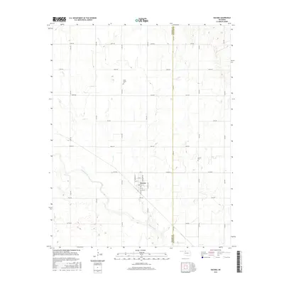
2016 Map of Dacoma
USGS Topo · Published 2016About this map
Dacoma serves as the central hub of this agricultural landscape, situated at the intersection of a grid-iron road network and the upper reaches of the Cimarron River drainage basin. The town's layout is defined by streets with regional and historic naming conventions, including Cherokee St, Arapahoe Ave, and Comanche Ave. Outside the town center, the terrain is shaped by the meandering paths of Eagle Chief Cr and Lake Cr, which provide a contrast to the geometric section lines of the surrounding farm country.
Find a feature on this map
37 named features on this map. Tap any name to fly to it.
Don’t see what you’re looking for? This feature index may not catch every label — zoom into the map to look around manually.
Map Details
Editions of this 2016 Dacoma Map
This is the sole edition of this map. No revisions or reprints were ever made.
Other maps of this area

1955 · Woodward
USGS Topo · 1:250,000

1958 · Woodward
USGS Topo · 1:250,000

1968 · Carmen
USGS Topo · 1:24,000

1969 · Dacoma
USGS Topo · 1:24,000

1969 · Lambert
USGS Topo · 1:24,000

1969 · Alva SE
USGS Topo · 1:24,000

1969 · Dacoma SW
USGS Topo · 1:24,000

1969 · Hopeton
USGS Topo · 1:24,000

1969 · Ingersoll
USGS Topo · 1:24,000
1969 · Alva
USGS Topo · 1:24,000