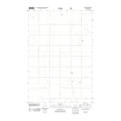
2011 Map of Daglum
USGS Topo · Published 2011About this map
Daglum is the focal point of this Stark County landscape, situated amidst the distinct topography of southwestern North Dakota. The area's settlement pattern is defined by a rigorous grid of section-line roads, including 122nd Ave SW and 49th St SW, which serve the agricultural plots surrounding the townsite. Local heritage is centered at the Daglum Cemetery, located south of the main settlement along the same corridor. The terrain is marked by significant natural landmarks such as the Little Badlands in the north and the prominent Flagstaff Butte further south. Drainage for the region is provided by the meandering path of Antelope Creek, which winds through the central portion of the quadrangle. Fisher Dam provides a localized water catchment, illustrating the intersection of natural watercourses and small-scale infrastructure required for prairie life.
Find a feature on this map
19 named features on this map. Tap any name to fly to it.
Don’t see what you’re looking for? This feature index may not catch every label — zoom into the map to look around manually.
Map Details
Editions of this 2011 Daglum Map
This is the sole edition of this map. No revisions or reprints were ever made.
Other maps of this area

1953 · Dickinson
USGS Topo · 1:250,000

1957 · Dickinson
USGS Topo · 1:250,000

1961 · Daglum
USGS Topo · 1:62,500

1962 · Belfield SW
USGS Topo · 1:24,000

1962 · Belfield SE
USGS Topo · 1:24,000

1973 · New England NW
USGS Topo · 1:24,000

1973 · New England SW
USGS Topo · 1:24,000
1973 · South Heart
USGS Topo · 1:24,000

1980 · Belfield
USGS Topo · 1:100,000
1981 · Dickinson
USGS Topo · 1:100,000