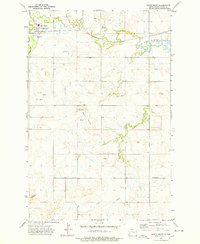
1973 Map of South Heart
USGS Topo · Published 1978About this map
South Heart sits at the confluence of the Heart River and North Creek, serving as a focal point for this Stark County landscape in the early 1970s. The town's layout is clearly defined, including the local St Marys Ch and infrastructure like the Sewage Disposal Ponds to the north. Transportation and water management dominate the northern half of the map, where the Burlington Northern railroad tracks parallel the river valley, leading toward the eastern reservoir at Edward Arthur Patterson Lake and its Spillway 2416.
Find a feature on this map
17 named features on this map. Tap any name to fly to it.
Don’t see what you’re looking for? This feature index may not catch every label — zoom into the map to look around manually.
Map Details
Editions of this 1973 South Heart Map
This is the sole edition of this map. No revisions or reprints were ever made.
Other maps of this area

1953 · Dickinson
USGS Topo · 1:250,000

1957 · Dickinson
USGS Topo · 1:250,000

1959 · Dickinson North
USGS Topo · 1:24,000

1959 · Dickinson South
USGS Topo · 1:24,000

1961 · Daglum
USGS Topo · 1:62,500

1962 · Belfield NE
USGS Topo · 1:24,000

1962 · Belfield SE
USGS Topo · 1:24,000

1973 · New Hradec South
USGS Topo · 1:24,000

1973 · New England NW
USGS Topo · 1:24,000

1973 · Schefield
USGS Topo · 1:24,000