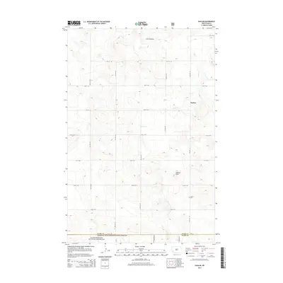
2014 Map of Daglum
USGS Topo · Published 2014About this map
Daglum and the surrounding high plains of Stark Co and Slope Co are defined by a rhythmic grid of section-line roads, such as 52nd St SW and 122nd Ave SW. This area of southwestern North Dakota is characterized by its high elevation and distinctive landforms, including the broken terrain of the Little Badlands and the prominent height of Flagstaff Butte. The settlement itself is sparse, reflecting the rural ranching and farming character of the region.
Find a feature on this map
24 named features on this map. Tap any name to fly to it.
Don’t see what you’re looking for? This feature index may not catch every label — zoom into the map to look around manually.
Map Details
Editions of this 2014 Daglum Map
This is the sole edition of this map. No revisions or reprints were ever made.
Other maps of this area

1953 · Dickinson
USGS Topo · 1:250,000

1957 · Dickinson
USGS Topo · 1:250,000

1961 · Daglum
USGS Topo · 1:62,500

1962 · Belfield SW
USGS Topo · 1:24,000

1962 · Belfield SE
USGS Topo · 1:24,000

1973 · New England NW
USGS Topo · 1:24,000

1973 · New England SW
USGS Topo · 1:24,000
1973 · South Heart
USGS Topo · 1:24,000

1980 · Belfield
USGS Topo · 1:100,000
1981 · Dickinson
USGS Topo · 1:100,000