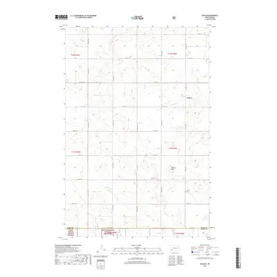
2017 Map of Daglum
USGS Topo · Published 2017About this map
Daglum sits on the high plains of Stark County, where the land begins to roll toward the breaks of the Badlands. This 2017 survey details a landscape defined by the Public Land Survey System, with a rigid grid of gravel roads like 49th St SW and 122nd Ave SW cutting across the drainage of Antelope Cr. The map captures the quiet character of western North Dakota, dominated by large-scale ranching and agriculture. Notable local landmarks include the prominent elevation of Flagstaff Butte and the Daglum Cem, which serves as a poignant physical record of the families who settled this open country. To the south, the terrain transitions at the Stark Co Slope Co boundary as it enters the protected borders of the Little Missouri National Grassland.
Find a feature on this map
27 named features on this map. Tap any name to fly to it.
Don’t see what you’re looking for? This feature index may not catch every label — zoom into the map to look around manually.
Map Details
Editions of this 2017 Daglum Map
This is the sole edition of this map. No revisions or reprints were ever made.
Other maps of this area

1953 · Dickinson
USGS Topo · 1:250,000

1957 · Dickinson
USGS Topo · 1:250,000

1961 · Daglum
USGS Topo · 1:62,500

1962 · Belfield SW
USGS Topo · 1:24,000

1962 · Belfield SE
USGS Topo · 1:24,000

1973 · New England NW
USGS Topo · 1:24,000

1973 · New England SW
USGS Topo · 1:24,000
1973 · South Heart
USGS Topo · 1:24,000

1980 · Belfield
USGS Topo · 1:100,000
1981 · Dickinson
USGS Topo · 1:100,000