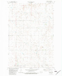
1982 Map of Daglum
USGS Topo · Published 1983About this map
The Little Missouri National Grassland dominates the southern landscape of this 1980s North Dakota survey, where the rugged topography of the Little Badlands meets the open range. The small settlement of Daglum serves as a local landmark, anchored by the presence of the Daglum Ch north of Antelope Creek. This era of the region’s development is characterized by a mix of conservation land and small-scale infrastructure, visible in features like the Fisher Dam and a local Gravel Pit near the boundary between Stark Co and Slope Co. The terrain is marked by distinctive elevations such as Flagstaff Butte, providing a detailed look at the rural character of the southwestern part of the state before modern large-scale energy development transformed much of the surrounding prairie.
Find a feature on this map
10 named features on this map. Tap any name to fly to it.
Don’t see what you’re looking for? This feature index may not catch every label — zoom into the map to look around manually.
Map Details
Editions of this 1982 Daglum Map
This is the sole edition of this map. No revisions or reprints were ever made.
Other maps of this area

1953 · Dickinson
USGS Topo · 1:250,000

1957 · Dickinson
USGS Topo · 1:250,000

1961 · Daglum
USGS Topo · 1:62,500

1962 · Belfield SW
USGS Topo · 1:24,000

1962 · Belfield SE
USGS Topo · 1:24,000

1973 · New England NW
USGS Topo · 1:24,000

1973 · New England SW
USGS Topo · 1:24,000
1973 · South Heart
USGS Topo · 1:24,000

1980 · Belfield
USGS Topo · 1:100,000
1981 · Dickinson
USGS Topo · 1:100,000