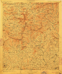
1903 Map of Dahlonega
USGS Topo · Published 1910About this map
Dahlonega serves as a primary hub in this mountain landscape, recorded during surveys at the end of the 19th century. The map illustrates a complex network of gaps and peaks along the North Carolina Georgia boundary line, including Hightower Bald and Davy Mt. The region's early transportation infrastructure is well-documented, featuring the Southern Railway and the Tallulah Falls RR carving through the valleys. Waterways like the Hiwassee River and Chattahoochee River dictate the placement of early infrastructure, such as Reeds Ferry and Amos Ford. Local life is anchored by smaller settlements and landmarks like Young Harris, Porter Springs, and a notable Indian Mound in the Nacoochee Valley. The map captures a moment before modern development, where the economy relied on the rail lines and river crossings that connected these high-altitude communities.
Find a feature on this map
203 named features on this map. Tap any name to fly to it.
Don’t see what you’re looking for? This feature index may not catch every label — zoom into the map to look around manually.
Map Details
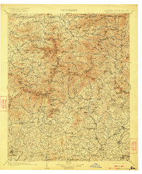
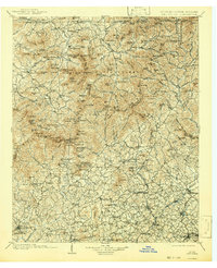
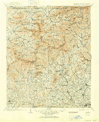
Editions of this 1903 Dahlonega Map
5 editions found

Other maps of this area

1886 · Dahlonega
USGS Topo · 1:125,000

1886 · Walhalla
USGS Topo · 1:125,000

1888 · Ellijay
USGS Topo · 1:125,000

1890 · Suwanee
USGS Topo · 1:125,000

1891 · Cowee
USGS Topo · 1:125,000

1891 · Gainesville
USGS Topo · 1:125,000

1891 · Carnesville
USGS Topo · 1:125,000

1892 · Dahlonega
USGS Topo · 1:125,000

1892 · Walhalla
USGS Topo · 1:125,000

1892 · Ellijay
USGS Topo · 1:125,000