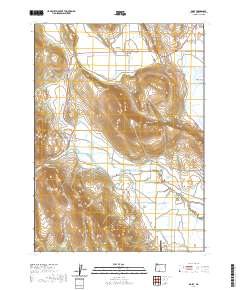
2020 Map of Dairy
USGS Topo · Published 2020About this map
Dairy sits at the intersection of high desert plateaus and fertile agricultural lowlands in Klamath County. The landscape is defined by the sharp verticality of Swan Lake Rim and Horton Rim, which overlook the expansive reaches of Poe Valley and Yonna Valley. Water management is central to the area's geography, evidenced by the winding path of the Lost River and the engineered precision of the B Canal and F-1 Lateral.
Find a feature on this map
32 named features on this map. Tap any name to fly to it.
Don’t see what you’re looking for? This feature index may not catch every label — zoom into the map to look around manually.
Map Details
Editions of this 2020 Dairy Map
This is the sole edition of this map. No revisions or reprints were ever made.
Other maps of this area

1889 · Klamath
USGS Topo · 1:250,000

1894 · Klamath
USGS Topo · 1:250,000

1955 · Klamath Falls
USGS Topo · 1:250,000

1957 · Merrill
USGS Topo · 1:62,500

1957 · Swan Lake
USGS Topo · 1:62,500

1957 · Malin
USGS Topo · 1:62,500

1958 · Klamath Falls
USGS Topo · 1:250,000

1960 · Beatty
USGS Topo · 1:62,500

1975 · Merrill NW
USGS Topo · 1:24,000
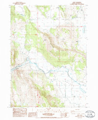
1985 · Dairy
USGS Topo · 1:24,000