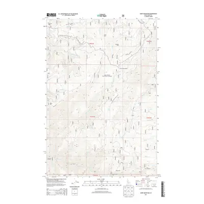
2013 Map of Dairy Mountain
USGS Topo · Published 2013About this map
The Nez Perce National Forest dominates this Idaho landscape, where high ridgelines and deep creek drainages define the wilderness character of the early 21st century. High points like Dairy Mtn, Asbestos Peak, and Jungle Point overlook a network of water sources such as Fenn Cabin Spring and Peter Ready Spring. Access into these mountain corridors is facilitated by named routes including Dairy Mtn Rd, Slate Creek Rd, and the Grangeville-Salmon Rd.
Find a feature on this map
45 named features on this map. Tap any name to fly to it.
Don’t see what you’re looking for? This feature index may not catch every label — zoom into the map to look around manually.
Map Details
Editions of this 2013 Dairy Mountain Map
This is the sole edition of this map. No revisions or reprints were ever made.
Other maps of this area

1931 · Buffalo Hump
USGS Topo · 1:125,000

1934 · Buffalo Hump
USGS Topo · 1:125,000

1955 · Grangeville
USGS Topo · 1:250,000

1956 · Elk City
USGS Topo · 1:250,000

1959 · Grangeville
USGS Topo · 1:250,000

1960 · Elk City
USGS Topo · 1:250,000

1963 · John Day Mtn
USGS Topo · 1:24,000

1963 · McKinzie Creek
USGS Topo · 1:24,000

1963 · Goodwin Meadows
USGS Topo · 1:24,000

1963 · Hanover Mtn.
USGS Topo · 1:24,000