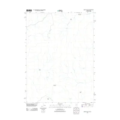
2012 Map of Dairy Valley
USGS Topo · Published 2012About this map
China Jim Mountain and the high basins of Box Elder County define this remote borderland where northern Utah meets Nevada. The landscape is characterized by a significant density of water sources in an otherwise arid environment, including Dairy Valley Springs, Willow Spring, and the aptly named Lost Spring. These perennial points of water likely served as critical landmarks for early ranching and travel through Long Canyon and the Monte Basin.
Find a feature on this map
18 named features on this map. Tap any name to fly to it.
Don’t see what you’re looking for? This feature index may not catch every label — zoom into the map to look around manually.
Map Details
Editions of this 2012 Dairy Valley Map
This is the sole edition of this map. No revisions or reprints were ever made.
Other maps of this area

1954 · Brigham City
USGS Topo · 1:250,000

1955 · Wells
USGS Topo · 1:250,000

1958 · Wells
USGS Topo · 1:250,000

1958 · Brigham City
USGS Topo · 1:250,000

1961 · Wells
USGS Topo · 1:250,000

1961 · Dairy Valley
USGS Topo · 1:62,500

1962 · Brigham City
USGS Topo · 1:250,000

1967 · Jackson Spring
USGS Topo · 1:24,000

1967 · Twelvemile Ranch
USGS Topo · 1:24,000
1967 · Lucin NW
USGS Topo · 1:24,000