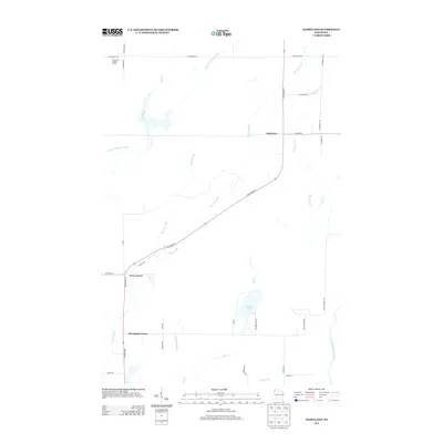
2013 Map of Dairyland
USGS Topo · Published 2013About this map
The Dairyland Lookout Tower stands as a prominent landmark in this northern Wisconsin landscape, overlooking the confluence of forest and small settlements. The area is defined by a network of north-south and east-west roads, centered on the intersection at Dairyland. To the south, the junctions at Cozy Corner and Woodland Corner serve as primary navigational hubs. The terrain is deeply intertwined with several water systems, most notably the Upper Tamarack River in the northwest and the Saint Croix River in the southeast corner. Numerous drainage features like Boyles Brook, Chases Brook, and Toad Creek feed into these larger systems, reflecting a lowland character typical of the region. Local travel is facilitated by State Road 35 and a series of rural routes such as McGraw Lake Rd, which provides access to the shoreline of McGraw Lake.
Find a feature on this map
38 named features on this map. Tap any name to fly to it.
Don’t see what you’re looking for? This feature index may not catch every label — zoom into the map to look around manually.
Map Details
Editions of this 2013 Dairyland Map
This is the sole edition of this map. No revisions or reprints were ever made.
Other maps of this area

1949 · Danbury
USGS Topo · 1:48,000

1949 · Holyoke
USGS Topo · 1:48,000

1949 · Webb Lake
USGS Topo · 1:48,000

1949 · Patzau
USGS Topo · 1:48,000

1953 · Duluth
USGS Topo · 1:250,000

1955 · Webb Lake
USGS Topo · 1:62,500

1955 · Patzau
USGS Topo · 1:62,500

1958 · Duluth
USGS Topo · 1:250,000

1962 · Holyoke
USGS Topo · 1:62,500

1962 · Danbury
USGS Topo · 1:62,500