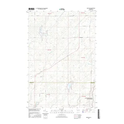
2015 Map of Dairyland
USGS Topo · Published 2015About this map
Dairyland and its surrounding wetlands occupy a landscape defined by glacial hydrology along the Douglas and Burnett County line. This 2015 record shows a rural settlement pattern anchored by the Dairyland Cemetery and a network of gravel and local roads like Town Rd T and Old 35 Rd. The terrain is dominated by complex water systems, from the meandering Upper Tamarack River and Radigan Flowage in the north to McGraw Lake further south. The southeastern corner is protected as part of the Saint Croix National Scenic Riverway, where the St Croix River cuts through the forest. Genealogists and historians will find interest in the scattered residential markers and named local roads such as Gomulak Rd and Cockerham Rd, which point to family legacies in this timber and marshland region.
Find a feature on this map
49 named features on this map. Tap any name to fly to it.
Don’t see what you’re looking for? This feature index may not catch every label — zoom into the map to look around manually.
Map Details
Editions of this 2015 Dairyland Map
This is the sole edition of this map. No revisions or reprints were ever made.
Other maps of this area

1949 · Danbury
USGS Topo · 1:48,000

1949 · Holyoke
USGS Topo · 1:48,000

1949 · Webb Lake
USGS Topo · 1:48,000

1949 · Patzau
USGS Topo · 1:48,000

1953 · Duluth
USGS Topo · 1:250,000

1955 · Webb Lake
USGS Topo · 1:62,500

1955 · Patzau
USGS Topo · 1:62,500

1958 · Duluth
USGS Topo · 1:250,000

1962 · Holyoke
USGS Topo · 1:62,500

1962 · Danbury
USGS Topo · 1:62,500