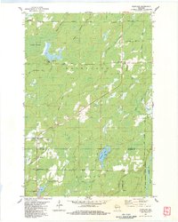
1983 Map of Dairyland
USGS Topo · Published 1983About this map
Kingsdale and Dairyland anchor a landscape defined by water and forest at the border of Douglas and Burnett counties. The Upper Tamarack River and Radigan Flowage dominate the northwestern terrain, while the southeastern corner is protected by the St Croix National Scenic Riverway. This 1983 survey shows a sparse but established settlement pattern, where civic life is centered around landmarks like the Dairyland Sch, Covenant Ch, and the Dairyland Lookout Tower. Small crossroad communities such as Cozy Corner, Woodland Corner, and Glendenning appear as vital hubs for the local rural population. The presence of numerous Gravel Pits and the Dairyland Cem further document the mid-20th-century footprint of these townships.
Find a feature on this map
38 named features on this map. Tap any name to fly to it.
Don’t see what you’re looking for? This feature index may not catch every label — zoom into the map to look around manually.
Map Details
Editions of this 1983 Dairyland Map
This is the sole edition of this map. No revisions or reprints were ever made.
Other maps of this area

1949 · Danbury
USGS Topo · 1:48,000

1949 · Holyoke
USGS Topo · 1:48,000

1949 · Webb Lake
USGS Topo · 1:48,000

1949 · Patzau
USGS Topo · 1:48,000

1953 · Duluth
USGS Topo · 1:250,000

1955 · Webb Lake
USGS Topo · 1:62,500

1955 · Patzau
USGS Topo · 1:62,500

1958 · Duluth
USGS Topo · 1:250,000

1962 · Holyoke
USGS Topo · 1:62,500

1962 · Danbury
USGS Topo · 1:62,500