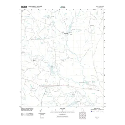
2011 Map of Daisy
USGS Topo · Published 2011About this map
The Canoochee River and Lotts Creek converge in this southeastern Georgia landscape, defining the rural character and historical drainage of the region. The community of Daisy serves as a central hub, supported by the Daisy Post Office, while smaller settlements like Bowen Mill and Anderson Mill indicate the local importance of water-powered industry along the regional branches. The map reveals a dense network of family-named landmarks and cemeteries, including the De Loach and Moore Cemetery and Sands Cemetery, providing valuable data for genealogical research. Numerous impoundments such as Sims Pond and Anderson Pond are scattered across the terrain, illustrating the managed water systems used for agriculture and recreation. In the western portion, the Claxton-Evans County Airport marks a modern utility point, contrasting with the traditional river crossings found at Rogers Bridge and Moores Bridge along the primary county roads.
Find a feature on this map
98 named features on this map. Tap any name to fly to it.
Don’t see what you’re looking for? This feature index may not catch every label — zoom into the map to look around manually.
Map Details
Editions of this 2011 Daisy Map
This is the sole edition of this map. No revisions or reprints were ever made.
Other maps of this area

1919 · Claxton
USGS Topo · 1:62,500

1920 · Pembroke
USGS Topo · 1:62,500

1920 · Statesboro
USGS Topo · 1:62,500

1921 · Brooklet
USGS Topo · 1:62,500

1943 · Brooklet
USGS Topo · 1:62,500

1943 · Statesboro
USGS Topo · 1:62,500

1944 · Claxton
USGS Topo · 1:62,500

1947 · Savannah
USGS Topo · 1:250,000

1948 · Savannah
USGS Topo · 1:250,000

1948 · Pembroke
USGS Topo · 1:62,500