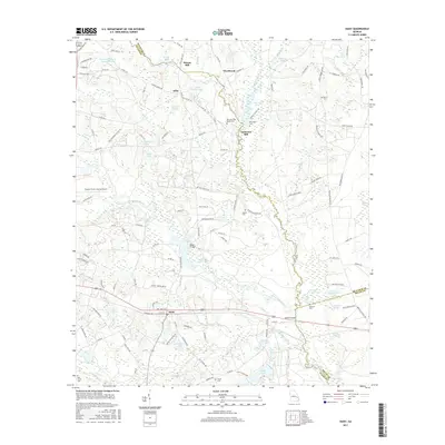
2017 Map of Daisy
USGS Topo · Published 2017About this map
Lotts Creek and the Canoochee River define this rural landscape on the border of Evans, Bulloch, and Bryan counties. The settlement of Daisy serves as a central point along the railroad, while historical industrial sites such as Anderson Mill and Bowen Mill appear along the creek banks. The map provides significant detail for genealogists, identifying numerous family-named landmarks and resting places including the Martin Cem, Edwards Cem, and the De Loach and Moore Cem. Wetland features and ponds dominate the eastern portion of the quadrangle, notably the Magnolia Springs area and the De Loach Upper Pond. Small rural communities like Edna are connected by a network of county roads and river crossings such as Rogers Bridge and Moores Bridge, illustrating the long-standing agricultural and river-based character of this Georgia region.
Find a feature on this map
126 named features on this map. Tap any name to fly to it.
Don’t see what you’re looking for? This feature index may not catch every label — zoom into the map to look around manually.
Map Details
Editions of this 2017 Daisy Map
This is the sole edition of this map. No revisions or reprints were ever made.
Other maps of this area

1919 · Claxton
USGS Topo · 1:62,500

1920 · Pembroke
USGS Topo · 1:62,500

1920 · Statesboro
USGS Topo · 1:62,500

1921 · Brooklet
USGS Topo · 1:62,500

1943 · Brooklet
USGS Topo · 1:62,500

1943 · Statesboro
USGS Topo · 1:62,500

1944 · Claxton
USGS Topo · 1:62,500

1947 · Savannah
USGS Topo · 1:250,000

1948 · Savannah
USGS Topo · 1:250,000

1948 · Pembroke
USGS Topo · 1:62,500