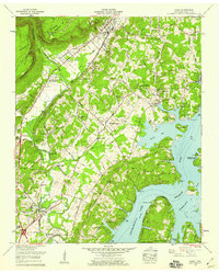
1958 Map of Daisy
USGS Topo · Published 1959About this map
Chickamauga Lake and the winding Tennessee River define the eastern reach of this 1958 Tennessee Valley Authority survey, illustrating a landscape transformed by mid-century water management. The community of Daisy sits at the foot of the Walden Ridge and the dramatic Cumberland Escarpment, while Hixson serves as a hub further south along the Southern Railway. The map captures a transitional era of suburban growth and recreation, featuring the developing Bartlebaugh Subdivision alongside established summer destinations like Camp Columbus and Camp Dixie. Local industry and infrastructure are represented by landmarks such as Greens Mill, a Substation, and a Drag Strip near Middle Valley. For genealogists, the sheet is exceptionally detailed, recording numerous family burial grounds including the Foster Hixson Cem, Hensley Cem, and the Johnson Cem, alongside community landmarks like Burks Chapel and New Salem Ch.
Find a feature on this map
80 named features on this map. Tap any name to fly to it.
Don’t see what you’re looking for? This feature index may not catch every label — zoom into the map to look around manually.
Map Details
Editions of this 1958 Daisy Map
2 editions found
Other maps of this area

1888 · Chattanooga
USGS Topo · 1:125,000

1893 · Chattanooga
USGS Topo · 1:125,000

1935 · East Chattanooga
USGS Topo · 1:24,000

1935 · Daisy
USGS Topo · 1:24,000

1935 · Soddy
USGS Topo · 1:24,000

1935 · Snow Hill
USGS Topo · 1:24,000

1935 · Ooltewah
USGS Topo · 1:24,000

1935 · Soddy Island
USGS Topo · 1:24,000

1936 · Henson Gap
USGS Topo · 1:24,000

1936 · Fairmount
USGS Topo · 1:24,000