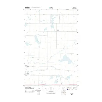
2010 Map of Dale
USGS Topo · Published 2010About this map
Buffalo River and its tributary Hay Creek snake through this rural Clay County landscape, defining the hydrology of a region dotted with numerous small basins. Named water bodies like Stinking Lake, Swede Grove Lake, and Rustad Lake are scattered across a grid of agricultural section lines and county highways. The settlement pattern is rooted in rail history, evidenced by the presence of Manitoba Junction and Winnipeg Junction, which flank the small community of Dale.
Find a feature on this map
46 named features on this map. Tap any name to fly to it.
Don’t see what you’re looking for? This feature index may not catch every label — zoom into the map to look around manually.
Map Details
Editions of this 2010 Dale Map
This is the sole edition of this map. No revisions or reprints were ever made.
Other maps of this area

1918 · Flom
USGS Topo · 1:62,500

1918 · Ulen
USGS Topo · 1:62,500

1919 · Hawley
USGS Topo · 1:62,500

1952 · Grand Forks
USGS Topo · 1:250,000

1953 · Fargo
USGS Topo · 1:250,000

1956 · Fargo
USGS Topo · 1:250,000

1956 · Grand Forks
USGS Topo · 1:250,000

1966 · Grand Forks
USGS Topo · 1:250,000
1966 · Tilde Lake
USGS Topo · 1:24,000
1966 · Flom SE
USGS Topo · 1:24,000