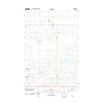
2013 Map of Dale
USGS Topo · Published 2013About this map
The Buffalo River snakes across this prairie landscape along the border of Clay and Becker counties, marking a region defined by its glacial lakes and early transport junctions. Manitoba Junction and Winnipeg Junction highlight the area's historical significance as a crossroads for rail traffic heading toward the Canadian border, while the small settlement of Dale sits centrally near the river's path. The map is particularly rich for genealogical research, documenting numerous burial sites including Dale Cem, Highland Grove Cem, and Eskjo Cem. The terrain is peppered with distinct water bodies such as Stinking Lake, Swede Grove Lake, and Cuba Lake, reflecting the characteristic pothole geology of western Minnesota. This documentation of cemetery locations and named water features provides a clear look at the rural social and physical geography of the area.
Find a feature on this map
41 named features on this map. Tap any name to fly to it.
Don’t see what you’re looking for? This feature index may not catch every label — zoom into the map to look around manually.
Map Details
Editions of this 2013 Dale Map
This is the sole edition of this map. No revisions or reprints were ever made.
Other maps of this area

1918 · Flom
USGS Topo · 1:62,500

1918 · Ulen
USGS Topo · 1:62,500

1919 · Hawley
USGS Topo · 1:62,500

1952 · Grand Forks
USGS Topo · 1:250,000

1953 · Fargo
USGS Topo · 1:250,000

1956 · Fargo
USGS Topo · 1:250,000

1956 · Grand Forks
USGS Topo · 1:250,000

1966 · Grand Forks
USGS Topo · 1:250,000
1966 · Tilde Lake
USGS Topo · 1:24,000
1966 · Flom SE
USGS Topo · 1:24,000