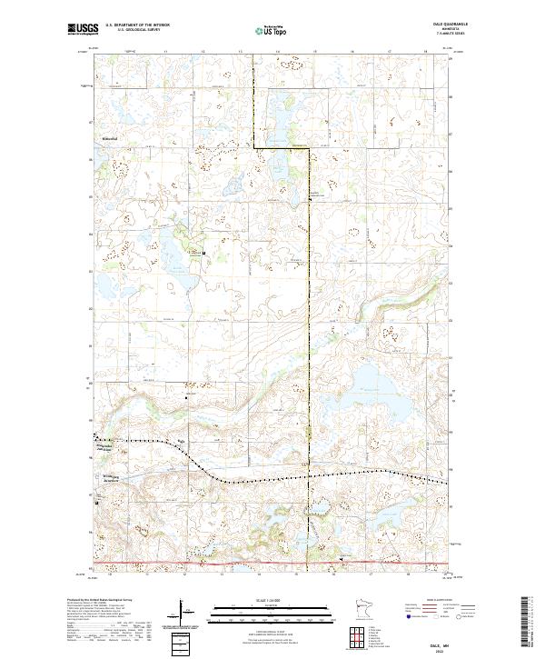
2022 Map of Dale
USGS Topo · Published 2022About this map
Hitterdal and the surrounding prairie of northwestern Minnesota are defined by a network of glacial lakes and critical transit points. The topography is marked by a series of significant water bodies, including Swede Grove Lake, Rustad Lake, and the larger Stinking Lake, which feed into the meandering Buffalo River. The landscape reflects the region's agricultural and rail history, evident in the junctions that once anchored local transport. Settlement patterns are highlighted by community hubs like Winnipeg Junction and Manitoba Junction, while the cultural history of the Scandinavian settlers is preserved through sites such as the Swedish Lutheran Cem and Highland Grove Cem. These cemeteries, along with Dale Covenant Cem and Eskjo Cem, provide essential markers for genealogical research in this part of Clay and Becker counties. The map also traces the winding course of Hay Cr as it flows through the township of Dale, illustrating the intersection of water resources and early homesteading.
Find a feature on this map
48 named features on this map. Tap any name to fly to it.
Don’t see what you’re looking for? This feature index may not catch every label — zoom into the map to look around manually.
Map Details
Editions of this 2022 Dale Map
This is the sole edition of this map. No revisions or reprints were ever made.
Other maps of this area

1918 · Flom
USGS Topo · 1:62,500

1918 · Ulen
USGS Topo · 1:62,500

1919 · Hawley
USGS Topo · 1:62,500

1952 · Grand Forks
USGS Topo · 1:250,000

1953 · Fargo
USGS Topo · 1:250,000

1956 · Fargo
USGS Topo · 1:250,000

1956 · Grand Forks
USGS Topo · 1:250,000

1966 · Grand Forks
USGS Topo · 1:250,000
1966 · Tilde Lake
USGS Topo · 1:24,000
1966 · Flom SE
USGS Topo · 1:24,000