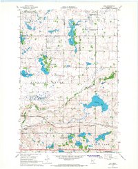
1966 Map of Dale
USGS Topo · Published 1967About this map
The Northern Pacific railroad corridor defines the southern landscape of this Clay County region, connecting the small settlements of Manitoba Junction, Winnipeg Junction, and Dale. These rail junctions served as critical transit points for the local agricultural economy, situated along the undulating prairie and wetland terrain. The map documents a community deeply rooted in its local institutions, evidenced by the presence of Highland Grove Ch, Heide Ch, and the Dale Covenant Ch, along with the Dale Cem.
Find a feature on this map
40 named features on this map. Tap any name to fly to it.
Don’t see what you’re looking for? This feature index may not catch every label — zoom into the map to look around manually.
Map Details
Editions of this 1966 Dale Map
This is the sole edition of this map. No revisions or reprints were ever made.
Other maps of this area

1918 · Flom
USGS Topo · 1:62,500

1918 · Ulen
USGS Topo · 1:62,500

1919 · Hawley
USGS Topo · 1:62,500

1952 · Grand Forks
USGS Topo · 1:250,000

1953 · Fargo
USGS Topo · 1:250,000

1956 · Fargo
USGS Topo · 1:250,000

1956 · Grand Forks
USGS Topo · 1:250,000

1966 · Grand Forks
USGS Topo · 1:250,000
1966 · Tilde Lake
USGS Topo · 1:24,000
1966 · Flom SE
USGS Topo · 1:24,000