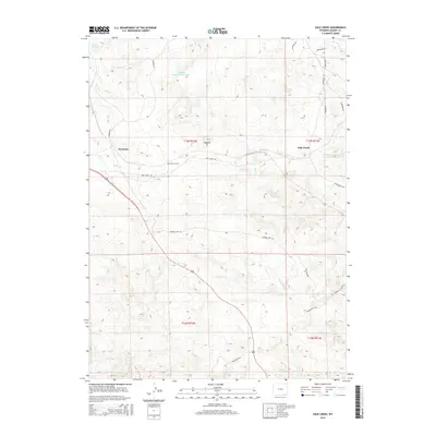
2015 Map of Dale Creek
USGS Topo · Published 2015About this map
Hermosa and Dale Creek anchor this high-plains landscape in Albany County, where the infrastructure of transportation and water management is clearly etched. The modern era of civil engineering is represented by the Hermosa Tunnel, while remnants of older transit routes persist along the Old Wagon Rd and Pumpkin Vine Rd. The importance of water in this semi-arid environment is evidenced by a network of controlled catchments, including Williams and Blunk Number 1 Reservoir, Williams Number 2 Reservoir, and Weaver Reservoir, all vital to the drainage basins of Dale Cr and the W Fork Dale Cr. Natural landmarks like the Natural Ft provide topographic orientation amidst a sprawling grid of ranch roads and township boundaries. This survey offers a detailed perspective on the transition from historic trails to contemporary rural infrastructure in the Wyoming hills.
Find a feature on this map
31 named features on this map. Tap any name to fly to it.
Don’t see what you’re looking for? This feature index may not catch every label — zoom into the map to look around manually.
Map Details
Editions of this 2015 Dale Creek Map
This is the sole edition of this map. No revisions or reprints were ever made.
Other maps of this area

1895 · Laramie
USGS Topo · 1:125,000

1902 · Laramie
USGS Topo · 1:125,000

1905 · Sherman
USGS Topo · 1:125,000

1905 · Laramie
USGS Topo · 1:125,000

1906 · Laramie
USGS Topo · 1:125,000

1907 · Livermore
USGS Topo · 1:125,000

1908 · Laramie
USGS Topo · 1:125,000

1909 · Livermore
USGS Topo · 1:125,000

1916 · Home
USGS Topo · 1:125,000

1920 · Home
USGS Topo · 1:125,000