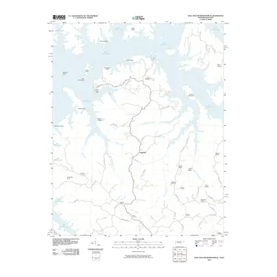
2010 Map of Dale Hollow Reservoir SE
USGS Topo · Published 2010About this map
Fairview serves as the central settlement hub on this map, situated in a landscape dominated by the branching waters of Dale Hollow Lake. The intricate shoreline is punctuated by numerous named landmarks, including Geiger Island, Opossum Island, and the precipitous Accordion Bluff. This area, once a network of mountain hollows like Allred Hollow and Jennings Hollow, has been transformed by the reservoir, leaving high ground features like Heard Ridge and Mohawk Ridge overlooking the water.
Find a feature on this map
62 named features on this map. Tap any name to fly to it.
Don’t see what you’re looking for? This feature index may not catch every label — zoom into the map to look around manually.
Map Details
Editions of this 2010 Dale Hollow Reservoir SE Map
This is the sole edition of this map. No revisions or reprints were ever made.
Other maps of this area

1897 · Standingstone
USGS Topo · 1:125,000

1898 · Standingstone
USGS Topo · 1:125,000

1924 · Lillydale
USGS Topo · 1:62,500

1926 · Lillydale
USGS Topo · 1:62,500

1929 · Lillydale
USGS Topo · 1:62,500

1929 · Byrdstown
USGS Topo · 1:62,500

1944 · Livingston
USGS Topo · 1:24,000

1954 · Frogue
USGS Topo · 1:24,000

1954 · Blacks Ferry
USGS Topo · 1:24,000

1954 · Albany
USGS Topo · 1:24,000