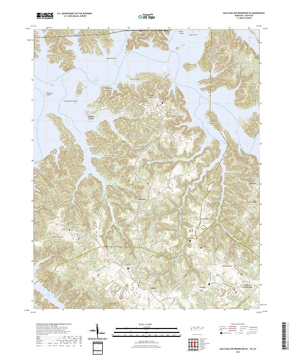
2022 Map of Dale Hollow Reservoir SE
USGS Topo · Published 2022About this map
Dale Hollow Lake dominates the northern landscape of this region, where the flooded valleys of the Cumberland Plateau create a complex shoreline of inlets and islands. Historically significant settlements like Willow Grove and Saint John sit near the water's edge, connected by a network of rural roads such as Willow Grove Rd and St Johns Pl. The rugged topography is defined by prominent ridges and knobs, including Chowning Knob and Mohawk Ridge, which hem in the narrow hollows and creek beds.
Find a feature on this map
94 named features on this map. Tap any name to fly to it.
Don’t see what you’re looking for? This feature index may not catch every label — zoom into the map to look around manually.
Map Details
Editions of this 2022 Dale Hollow Reservoir SE Map
This is the sole edition of this map. No revisions or reprints were ever made.
Other maps of this area

1897 · Standingstone
USGS Topo · 1:125,000

1898 · Standingstone
USGS Topo · 1:125,000

1924 · Lillydale
USGS Topo · 1:62,500

1926 · Lillydale
USGS Topo · 1:62,500

1929 · Lillydale
USGS Topo · 1:62,500

1929 · Byrdstown
USGS Topo · 1:62,500

1944 · Livingston
USGS Topo · 1:24,000

1954 · Frogue
USGS Topo · 1:24,000

1954 · Blacks Ferry
USGS Topo · 1:24,000

1954 · Albany
USGS Topo · 1:24,000