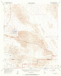
1956 Map of Dale Lake
USGS Topo · Published 1963About this map
Mining operations and industrial salt production dominate this mid-century survey of the California desert. The northern reaches of the Pinto Mountains and the Joshua Tree National Monument boundary are marked by a high concentration of hard-rock mines, including the Supply Mine, Brooklyn Mine, and Iron Age Mine, many of which feature mapped tunnels and shafts. This industrial activity contrast with the vast Sand Dunes and the prominent Dale Lake basin.
Find a feature on this map
38 named features on this map. Tap any name to fly to it.
Don’t see what you’re looking for? This feature index may not catch every label — zoom into the map to look around manually.
Map Details
Editions of this 1956 Dale Lake Map
3 editions found

Other maps of this area

1942 · Amboy
USGS Topo · 1:250,000

1943 · Amboy
USGS Topo · 1:250,000

1943 · Cadiz Lake
USGS Topo · 1:62,500

1943 · Cadiz Valley
USGS Topo · 1:62,500

1943 · Coxcomb Mountains
USGS Topo · 1:62,500

1943 · Pinkham Well
USGS Topo · 1:62,500

1944 · Pinkham Well
USGS Topo · 1:62,500

1944 · Eagle Tank
USGS Topo · 1:62,500

1944 · Coxcomb Mountains
USGS Topo · 1:62,500

1954 · Salton Sea
USGS Topo · 1:250,000