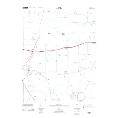
2013 Map of Dale
USGS Topo · Published 2013About this map
Dale serves as a primary settlement in this corner of southern Indiana, where modern infrastructure meets the rural landscapes of Spencer and Dubois Counties. The community is anchored by local landmarks like Dale Reservoir and the intersection of historic routes including Old US 231. To the north and east, the map details smaller rural centers such as Mariah Hill, Saint Henry, and Johnsburg, each connected by an extensive network of county roads that cut through the drainage basins of Little Pigeon Cr and Hunley Cr.
Find a feature on this map
75 named features on this map. Tap any name to fly to it.
Don’t see what you’re looking for? This feature index may not catch every label — zoom into the map to look around manually.
Map Details
Editions of this 2013 Dale Map
This is the sole edition of this map. No revisions or reprints were ever made.
Other maps of this area

1900 · St Meinrad
USGS Topo · 1:62,500

1900 · De Gonia Springs
USGS Topo · 1:62,500

1902 · Ditney
USGS Topo · 1:125,000

1902 · Degonia Springs
USGS Topo · 1:62,500

1903 · St. Meinrad
USGS Topo · 1:62,500

1903 · Velpen
USGS Topo · 1:62,500

1954 · Huntingburg
USGS Topo · 1:24,000

1955 · Saint Anthony
USGS Topo · 1:24,000

1956 · Vincennes
USGS Topo · 1:250,000

1957 · Vincennes
USGS Topo · 1:250,000