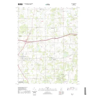
2019 Map of Dale
USGS Topo · Published 2019About this map
Lincoln Boyhood National Memorial sits at the southwestern edge of this landscape, marking the historic grounds where Abraham Lincoln spent his youth. The terrain transitions from the rolling uplands of Flint Hill down toward the drainage basins of Little Pigeon Cr and Hunley Cr. This modern survey illustrates the proximity of several distinct German-Catholic and rural communities including Ferdinand, Saint Henry, and Mariah Hill. Local genealogy is well-documented through numerous sites such as the Mary Help of Christians Church Cem and the small Pinkston Cem near the town of Santa Claus. The mapping also highlights the dense network of county roads that link these settlements across the Dubois and Spencer county line, reflecting a landscape shaped by early 19th-century migration patterns that remain central to the region's identity.
Find a feature on this map
100 named features on this map. Tap any name to fly to it.
Don’t see what you’re looking for? This feature index may not catch every label — zoom into the map to look around manually.
Map Details
Editions of this 2019 Dale Map
This is the sole edition of this map. No revisions or reprints were ever made.
Other maps of this area

1900 · St Meinrad
USGS Topo · 1:62,500

1900 · De Gonia Springs
USGS Topo · 1:62,500

1902 · Ditney
USGS Topo · 1:125,000

1902 · Degonia Springs
USGS Topo · 1:62,500

1903 · St. Meinrad
USGS Topo · 1:62,500

1903 · Velpen
USGS Topo · 1:62,500

1954 · Huntingburg
USGS Topo · 1:24,000

1955 · Saint Anthony
USGS Topo · 1:24,000

1956 · Vincennes
USGS Topo · 1:250,000

1957 · Vincennes
USGS Topo · 1:250,000