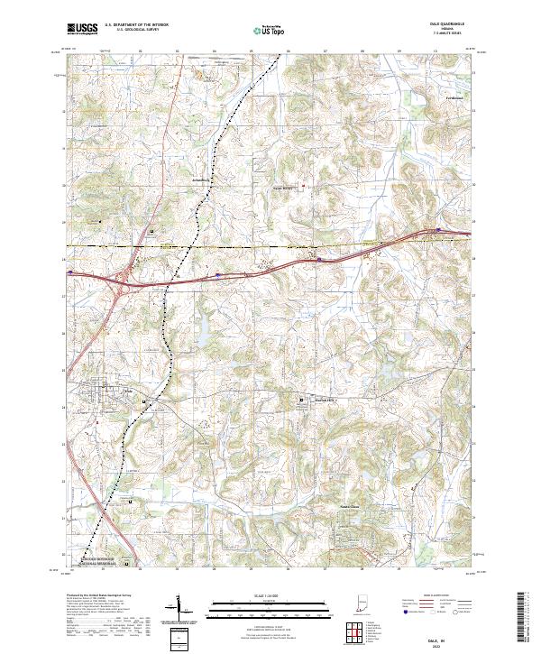
2022 Map of Dale
USGS Topo · Published 2022About this map
Lincoln Boyhood National Memorial anchors the southern landscape of this Spencer County region, preserving the site where Abraham Lincoln spent his formative years. The terrain is a network of small agricultural settlements and winding watercourses like Little Pigeon Cr and Hunley Cr. The map reveals the proximity of storied communities such as Dale and Santa Claus, alongside smaller hamlets like Johnsburg, Saint Henry, and Mariah Hill. Genealogists will find a high density of burial sites throughout the townships, including Pinkston Cem, Richardson Cem, and the Mary Help of Christians Church Cem. The northern border near the Dubois and Spencer County line is marked by the presence of Huntingburg Airport and the town of Ferdinand, illustrating the ongoing intersection of aviation, industry, and rural life in southern Indiana.
Find a feature on this map
71 named features on this map. Tap any name to fly to it.
Don’t see what you’re looking for? This feature index may not catch every label — zoom into the map to look around manually.
Map Details
Editions of this 2022 Dale Map
This is the sole edition of this map. No revisions or reprints were ever made.
Other maps of this area

1900 · St Meinrad
USGS Topo · 1:62,500

1900 · De Gonia Springs
USGS Topo · 1:62,500

1902 · Ditney
USGS Topo · 1:125,000

1902 · Degonia Springs
USGS Topo · 1:62,500

1903 · St. Meinrad
USGS Topo · 1:62,500

1903 · Velpen
USGS Topo · 1:62,500

1954 · Huntingburg
USGS Topo · 1:24,000

1955 · Saint Anthony
USGS Topo · 1:24,000

1956 · Vincennes
USGS Topo · 1:250,000

1957 · Vincennes
USGS Topo · 1:250,000