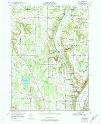
1949 Map of Dale
USGS Topo · Published 1984About this map
Tonawanda Creek and its tributary Little Tonawanda Creek carve a distinct north-south drainage pattern through this landscape, which in 1949 remained deeply agricultural with scattered rural hamlets. The Erie RR winds through the central valley, serving small transport points such as Linden and Dale. These communities, along with West Middlebury and Orangeville Center, define the social geography of the era.
Find a feature on this map
79 named features on this map. Tap any name to fly to it.
Don’t see what you’re looking for? This feature index may not catch every label — zoom into the map to look around manually.
Map Details
Editions of this 1949 Dale Map
3 editions found
Other maps of this area

1904 · Batavia
USGS Topo · 1:62,500

1905 · Attica
USGS Topo · 1:62,500

1905 · Portage
USGS Topo · 1:62,500

1923 · Arcade
USGS Topo · 1:62,500

1925 · Arcade
USGS Topo · 1:62,500

1943 · Warsaw
USGS Topo · 1:24,000

1943 · Castile
USGS Topo · 1:24,000

1944 · Alexander
USGS Topo · 1:31,680

1944 · Stafford
USGS Topo · 1:31,680

1944 · Warsaw
USGS Topo · 1:31,680