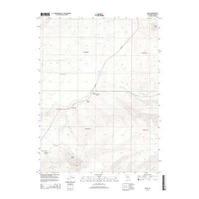
2015 Map of Dales
USGS Topo · Published 2015About this map
Dales stands at a central crossroads where Manton Rd meets the primary transit corridor through the Sacramento Valley. This landscape transitions from the flatlands of the Central Valley into the dissected plateau of the foothills, defined by numerous drainages including Paynes Cr and Inks Cr. The terrain is marked by significant volcanic landmarks, most notably the prominent Tuscan Buttes and the elevation of Soap Butte to the northeast. Water sources are critical to this arid environment, represented by Cottonwood Spring, Ross Gates Spring, and seasonal features like Dales Lake and Hog Lake. The map details the complex system of gulches, such as Supan Gulch and De Haven Gulch, which have historically dictated the placement of roads like Tuscan Springs Rd.
Find a feature on this map
24 named features on this map. Tap any name to fly to it.
Don’t see what you’re looking for? This feature index may not catch every label — zoom into the map to look around manually.
Map Details
Editions of this 2015 Dales Map
This is the sole edition of this map. No revisions or reprints were ever made.
Other maps of this area

1886 · Lassen Peak
USGS Topo · 1:250,000

1890 · Red Bluff
USGS Topo · 1:250,000

1892 · Lassen Peak
USGS Topo · 1:250,000

1894 · Lassen Peak
USGS Topo · 1:250,000

1894 · Red Bluff
USGS Topo · 1:250,000

1905 · Tehama
USGS Topo · 1:62,500

1935 · Paynes Creek
USGS Topo · 1:96,000

1941 · Mineral
USGS Topo · 1:125,000

1944 · Tuscan Buttes
USGS Topo · 1:62,500

1947 · Tuscan Buttes
USGS Topo · 1:62,500