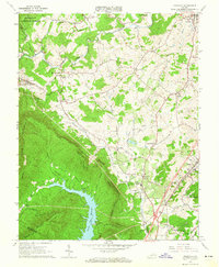
1963 Map of Daleville
USGS Topo · Published 1965About this map
Fincastle and the surrounding Botetourt County landscape are defined by the convergence of the Blue Ridge and Allegheny mountains in the early 1960s. The area maintains a strong agricultural and small-settlement character, with older communities like Amsterdam and Haymakertown situated amongst a network of creeks and ridges. The Norfolk and Western railroad corridor anchors the eastern valley, connecting Troutville and Daleville.
Find a feature on this map
53 named features on this map. Tap any name to fly to it.
Don’t see what you’re looking for? This feature index may not catch every label — zoom into the map to look around manually.
Map Details
Editions of this 1963 Daleville Map
4 editions found
Other maps of this area

1887 · Lewisburg
USGS Topo · 1:125,000

1890 · Roanoke
USGS Topo · 1:125,000

1890 · Christiansburg
USGS Topo · 1:125,000

1891 · Roanoke
USGS Topo · 1:125,000

1891 · Lewisburg
USGS Topo · 1:125,000

1894 · Natural Bridge
USGS Topo · 1:125,000

1913 · Eagle Rock
USGS Topo · 1:48,000

1915 · Eagle Rock
USGS Topo · 1:62,500

1929 · Roanoke
USGS Topo · 1:48,000

1929 · Salem
USGS Topo · 1:48,000