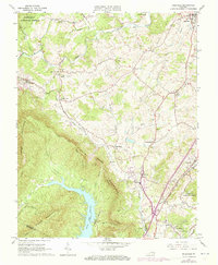
1963 Map of Daleville
USGS Topo · Published 1973About this map
Fincastle and the surrounding Botetourt County landscape represent a classic ridge-and-valley settlement pattern, where community life gathered in the fertile pockets between Tinker Mountain and Brushy Mountain. Local commerce and milling history are evident at Glebe Mills and Howell Mills, while the infrastructure of the Norfolk and Western railway links the larger settlements of Troutville and Daleville. The presence of numerous family-linked landmarks, such as Greenfield Cem and Peery Cem, alongside the Asbury Sch, provides valuable touchstones for genealogists tracking established rural families. To the southwest, the expansive Carvin Cove Reservoir dominates the terrain, buffered by the Jefferson National Forest. The route of the Appalachian Trail winds through these heights, crossing a landscape defined by industrial sites like a Mine and Quarry alongside newer developments like the Lord Botetourt High Sch.
Find a feature on this map
49 named features on this map. Tap any name to fly to it.
Don’t see what you’re looking for? This feature index may not catch every label — zoom into the map to look around manually.
Map Details
Editions of this 1963 Daleville Map
4 editions found
Other maps of this area

1887 · Lewisburg
USGS Topo · 1:125,000

1890 · Roanoke
USGS Topo · 1:125,000

1890 · Christiansburg
USGS Topo · 1:125,000

1891 · Roanoke
USGS Topo · 1:125,000

1891 · Lewisburg
USGS Topo · 1:125,000

1894 · Natural Bridge
USGS Topo · 1:125,000

1913 · Eagle Rock
USGS Topo · 1:48,000

1915 · Eagle Rock
USGS Topo · 1:62,500

1929 · Roanoke
USGS Topo · 1:48,000

1929 · Salem
USGS Topo · 1:48,000