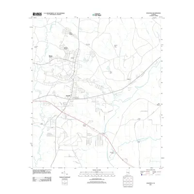
2011 Map of Daleville
USGS Topo · Published 2011About this map
Daleville serves as the central hub of this Dale County landscape, shaped significantly by its proximity to military aviation and the winding course of the Choctawhatchee River. The residential layout is characterized by distinct neighborhoods such as Allen Heights, Bowden Terrace, and Munson Heights, reflecting the area's growth and organization. Aviation infrastructure is prominent, with the Lowe AHP Airport and Hanchey AHP Airport flanking the town, while the Fort Rucker Post Office and Fort Rucker Dam near Beaver Lake indicate the significant federal presence in the region.
Find a feature on this map
74 named features on this map. Tap any name to fly to it.
Don’t see what you’re looking for? This feature index may not catch every label — zoom into the map to look around manually.
Map Details
Editions of this 2011 Daleville Map
This is the sole edition of this map. No revisions or reprints were ever made.
Other maps of this area

1942 · Enterprise
USGS Topo · 1:125,000

1948 · Ozark
USGS Topo · 1:62,500

1950 · Ozark
USGS Topo · 1:62,500

1950 · Enterprise
USGS Topo · 1:62,500

1953 · Dothan
USGS Topo · 1:250,000

1954 · Dothan
USGS Topo · 1:250,000

1955 · Dothan
USGS Topo · 1:250,000

1957 · Malvern
USGS Topo · 1:24,000

1957 · Geneva
USGS Topo · 1:62,500

1957 · Hartford
USGS Topo · 1:62,500