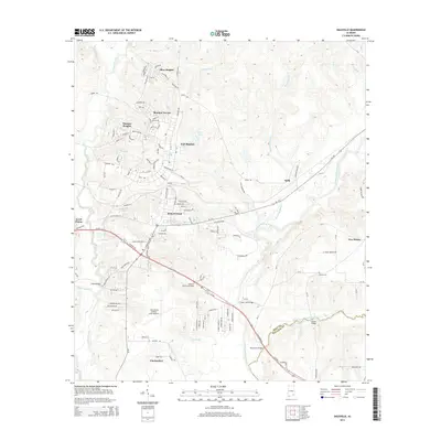
2014 Map of Daleville
USGS Topo · Published 2014About this map
Fort Rucker dominates the northern landscape of this region, its extensive road network and residential areas like Bowden Terrace and Allen Heights defining the area's development. The city of Daleville serves as the central hub, situated just north of Cairns Army Airfield. The map reveals a transition from these organized military and residential grids to the meandering paths of the Choctawhatchee River and its many tributaries, including Four Mile Cr and Claybank Creek. To the south, the settlement of Clayhatchee sits near the confluence of several waterways, where local crossings like Burnt Mill Bridge and Golden Bridge highlight the historical reliance on these river routes. Genealogists may find value in the location of Bethel Cem and Daleville Memorial Gardens, while the presence of the Lower Iron Bridge on the river indicates traditional infrastructure used to navigate the local drainage basins.
Find a feature on this map
131 named features on this map. Tap any name to fly to it.
Don’t see what you’re looking for? This feature index may not catch every label — zoom into the map to look around manually.
Map Details
Editions of this 2014 Daleville Map
This is the sole edition of this map. No revisions or reprints were ever made.
Other maps of this area

1942 · Enterprise
USGS Topo · 1:125,000

1948 · Ozark
USGS Topo · 1:62,500

1950 · Ozark
USGS Topo · 1:62,500

1950 · Enterprise
USGS Topo · 1:62,500

1953 · Dothan
USGS Topo · 1:250,000

1954 · Dothan
USGS Topo · 1:250,000

1955 · Dothan
USGS Topo · 1:250,000

1957 · Malvern
USGS Topo · 1:24,000

1957 · Geneva
USGS Topo · 1:62,500

1957 · Hartford
USGS Topo · 1:62,500