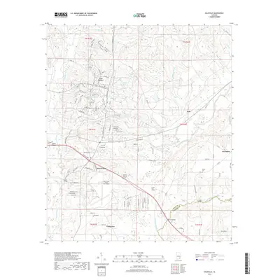
2018 Map of Daleville
USGS Topo · Published 2018About this map
Fort Rucker dominates the northern landscape of this Dale County region, defined by its complex network of military roads and the extensive Cairns Army Airfield. The settlement of Daleville serves as a primary hub just south of the installation, where residential streets give way to the sprawling grounds of the Daleville Memorial Gardens. The terrain is characterized by a series of creek drainages, including Claybank Creek and Steep Head Cr, which feed into the larger winding course of the Choctawhatchee River. Further south, the town of Clayhatchee marks the transition toward the Houston County line. Significant river crossings like Snell Bridge, Lower Iron Bridge, and Burnt Mill Bridge illustrate the importance of these waterways to the local transport infrastructure, connecting rural outposts like Kelly and Five Points to the region's main population centers.
Find a feature on this map
123 named features on this map. Tap any name to fly to it.
Don’t see what you’re looking for? This feature index may not catch every label — zoom into the map to look around manually.
Map Details
Editions of this 2018 Daleville Map
This is the sole edition of this map. No revisions or reprints were ever made.
Other maps of this area

1942 · Enterprise
USGS Topo · 1:125,000

1948 · Ozark
USGS Topo · 1:62,500

1950 · Ozark
USGS Topo · 1:62,500

1950 · Enterprise
USGS Topo · 1:62,500

1953 · Dothan
USGS Topo · 1:250,000

1954 · Dothan
USGS Topo · 1:250,000

1955 · Dothan
USGS Topo · 1:250,000

1957 · Malvern
USGS Topo · 1:24,000

1957 · Geneva
USGS Topo · 1:62,500

1957 · Hartford
USGS Topo · 1:62,500