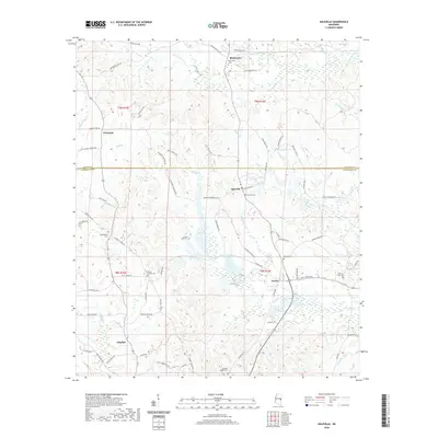
2020 Map of Daleville
USGS Topo · Published 2020About this map
Daleville and Lizelia anchor this portion of East Mississippi, where the headwaters of several drainages carve a intricate network through the landscape. The map reveals a high density of rural cemeteries, including Samuel Dale Cem and Arkadelphia Cem, which serve as critical markers for genealogists tracing family roots in Lauderdale and Kemper counties. The terrain is defined by watercourses like Ponta Cr and Mosley Br, which influenced the placement of early routes such as the Jackson Military Rd. Small settlements like Obadiah and Blackwater are connected by a web of local roads, reflecting a long-standing pattern of dispersed agricultural and timber-related land use. The presence of Kempdale Lake and numerous named branches suggests the importance of water management in this rural setting.
Find a feature on this map
75 named features on this map. Tap any name to fly to it.
Don’t see what you’re looking for? This feature index may not catch every label — zoom into the map to look around manually.
Map Details
Editions of this 2020 Daleville Map
This is the sole edition of this map. No revisions or reprints were ever made.
Other maps of this area

1921 · Meridian
USGS Topo · 1:48,000

1923 · Meridian
USGS Topo · 1:62,500

1953 · Meridian
USGS Topo · 1:250,000

1957 · Meridian
USGS Topo · 1:250,000

1957 · Chunky
USGS Topo · 1:62,500

1962 · Daleville
USGS Topo · 1:24,000

1962 · Lauderdale
USGS Topo · 1:24,000

1962 · Lauderdale NW
USGS Topo · 1:24,000

1962 · Center Hill
USGS Topo · 1:24,000

1962 · Oak Grove
USGS Topo · 1:24,000