
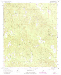
1962 Map of Oak Grove
USGS Topo · Published 1964About this map
The community of Oak Grove sits at the center of this rural Kemper County landscape, where small settlements and country churches are connected by a network of unimproved dirt roads and light-duty paths. The terrain is deeply carved by water, defined by the winding paths of Sucarnoochee Creek in the northeast and Pawticfaw Creek through the center. A notable concentration of community landmarks highlights the social fabric of the era, including Center Ridge Ch, Macedonia Ch, and Chapel Hill Ch.
Find a feature on this map
24 named features on this map. Tap any name to fly to it.
Don’t see what you’re looking for? This feature index may not catch every label — zoom into the map to look around manually.
Map Details
Editions of this 1962 Oak Grove Map
2 editions found
Other maps of this area

1953 · Meridian
USGS Topo · 1:250,000

1957 · Meridian
USGS Topo · 1:250,000

1962 · Daleville
USGS Topo · 1:24,000

1962 · Lauderdale
USGS Topo · 1:24,000

1962 · Lauderdale NW
USGS Topo · 1:24,000

1963 · De Kalb
USGS Topo · 1:24,000

1963 · Townsend
USGS Topo · 1:24,000

1965 · Meridian
USGS Topo · 1:250,000

1973 · Scooba
USGS Topo · 1:24,000
1974 · Tamola
USGS Topo · 1:24,000