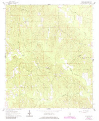
1962 Map of Oak Grove
USGS Topo · Published 1985About this map
Sucarnoochee Creek and Pawticfaw Creek drain this rural landscape of Kemper County, defining a network of ridges and stream valleys that shaped the region's early development. At the time of this 1962 survey, the area was a mosaic of woodland and small clearings, anchored by numerous country churches that served as the social hubs for dispersed families. Settlements like Oak Grove and Akron appear alongside family-named landmarks and infrastructure such as the Porterville Lookout Tower.
Find a feature on this map
22 named features on this map. Tap any name to fly to it.
Don’t see what you’re looking for? This feature index may not catch every label — zoom into the map to look around manually.
Map Details
Editions of this 1962 Oak Grove Map
2 editions found
Other maps of this area

1953 · Meridian
USGS Topo · 1:250,000

1957 · Meridian
USGS Topo · 1:250,000

1962 · Daleville
USGS Topo · 1:24,000

1962 · Lauderdale
USGS Topo · 1:24,000

1962 · Lauderdale NW
USGS Topo · 1:24,000

1962 · Oak Grove
USGS Topo · 1:24,000

1963 · De Kalb
USGS Topo · 1:24,000

1963 · Townsend
USGS Topo · 1:24,000

1965 · Meridian
USGS Topo · 1:250,000

1973 · Scooba
USGS Topo · 1:24,000