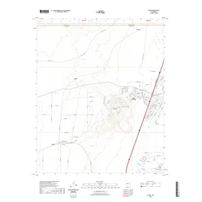
2020 Map of Dalies
USGS Topo · Published 2020About this map
El Cerro De Los Lunas dominates the central topography of this survey, surrounded by the suburban expansion of Los Lunas. This high volcanic plug and its associated landforms, including El Cerro Bowl and the El Cerro W Escarpment, provide a natural boundary for the residential developments creeping westward from the Rio Grande valley. The map details a complex network of modern residential streets such as Huning Ranch Dr and Camino Del Rey Dr Sw that contrast with the more open, traditional settlements of Dalies and Sandia. To the north, the boundary between Bernalillo Co and Valencia Co marks the edge of the Albuquerque metropolitan influence, while old Indian Service routes like Indian Svc Rte 610 suggest the long-standing transit corridors across this high desert landscape.
Find a feature on this map
89 named features on this map. Tap any name to fly to it.
Don’t see what you’re looking for? This feature index may not catch every label — zoom into the map to look around manually.
Map Details
Editions of this 2020 Dalies Map
This is the sole edition of this map. No revisions or reprints were ever made.
Other maps of this area

1952 · Wind Mesa
USGS Topo · 1:24,000

1952 · Dalies
USGS Topo · 1:24,000

1952 · Belen
USGS Topo · 1:24,000

1952 · Belen NW
USGS Topo · 1:24,000

1952 · Rio Puerco
USGS Topo · 1:24,000

1952 · Tome
USGS Topo · 1:24,000

1952 · Los Lunas
USGS Topo · 1:24,000

1952 · Isleta
USGS Topo · 1:24,000

1952 · Dalies NW
USGS Topo · 1:24,000

1954 · Socorro
USGS Topo · 1:250,000