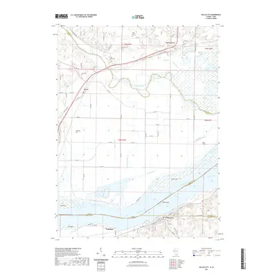
2021 Map of Dallas City
USGS Topo · Published 2021About this map
Dallas City and Pontoosuc anchor the southern Illinois bank of the Mississippi River in this modern topographical study. The river corridor is defined by numerous islands and sloughs, including Dallas Island, Grape Island, and Peel Island, while the northern Iowa bank features the winding course of the Skunk River as it approaches the confluence. The drainage patterns of the region are deeply detailed, showing how Big Slough, Rogers Ditch, and Old Township Ditch manage the low-lying bottomlands between the rivers.
Find a feature on this map
71 named features on this map. Tap any name to fly to it.
Don’t see what you’re looking for? This feature index may not catch every label — zoom into the map to look around manually.
Map Details
Editions of this 2021 Dallas City Map
This is the sole edition of this map. No revisions or reprints were ever made.
Other maps of this area

1932 · Lomax
USGS Topo · 1:62,500

1934 · Burlington
USGS Topo · 1:48,000

1936 · Fort Madison
USGS Topo · 1:62,500

1937 · Lomax
USGS Topo · 1:62,500

1940 · Burlington
USGS Topo · 1:62,500

1958 · Burlington
USGS Topo · 1:250,000

1961 · Burlington
USGS Topo · 1:250,000

1963 · Burlington
USGS Topo · 1:250,000
1964 · Burlington
USGS Topo · 1:24,000

1964 · Lomax
USGS Topo · 1:24,000