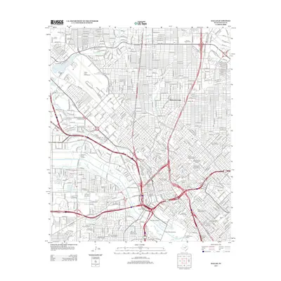
2012 Map of Dallas
USGS Topo · Published 2012About this map
The Trinity River corridor and its complex network of viaducts, including the Lamar Street Viaduct and Houston Street Viaduct, anchors this urban landscape during a period of extensive historic preservation. A high concentration of designated areas like the Swiss Avenue Historic District and South Boulevard-Park Row Historic District illustrates the city's commitment to its architectural heritage. The map documents significant infrastructure and landmarks, from the sprawling grounds of Dallas Love Field Airport in the northwest to the iconic Cotton Bowl in the east. Industrial remnants such as the Stanard-Tilton Flour Mill sit alongside prestigious institutions like Southern Methodist University. This survey provides a precise accounting of the city's cemeteries, including the centrally located Greenwood Cem and Emanuel Cem, which serve as vital touchstones for genealogical research within the urban core.
Find a feature on this map
51 named features on this map. Tap any name to fly to it.
Don’t see what you’re looking for? This feature index may not catch every label — zoom into the map to look around manually.
Map Details
Editions of this 2012 Dallas Map
This is the sole edition of this map. No revisions or reprints were ever made.
Other maps of this area

1891 · Dallas
USGS Topo · 1:125,000

1893 · Dallas
USGS Topo · 1:125,000

1925 · Dallas 2-b
USGS Topo · 1:48,000

1931 · Carrollton
USGS Topo · 1:62,500

1954 · Dallas
USGS Topo · 1:250,000

1957 · White Rock Lake
USGS Topo · 1:24,000

1958 · Dallas
USGS Topo · 1:250,000

1958 · Hutchins
USGS Topo · 1:24,000

1958 · Oak Cliff
USGS Topo · 1:24,000

1958 · Dallas
USGS Topo · 1:24,000