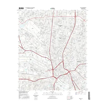
2016 Map of Dallas
USGS Topo · Published 2016About this map
Dallas and its immediate northern suburbs appear in high detail during this mid-2010s survey. The landscape is defined by the dense urban core and the prominent corridor of the Trinity River, which is spanned by several major thoroughfares including the Hampton Road Viaduct and the Lamar Street Viaduct. The presence of established residential enclaves like University Park and Highland Park contrasts with industrial and commercial zones near the river. Academic and cultural institutions are central to the area's layout, most notably the expansive Southern Methodist University campus. Further west, Dallas Love Field occupies a significant portion of the map, highlighting the city's role as a major transportation hub. Several historic burial grounds, such as Oakland Cemetery and Greenwood Cemetery, provide anchors for genealogical research within the city's evolving street grid.
Find a feature on this map
33 named features on this map. Tap any name to fly to it.
Don’t see what you’re looking for? This feature index may not catch every label — zoom into the map to look around manually.
Map Details
Editions of this 2016 Dallas Map
This is the sole edition of this map. No revisions or reprints were ever made.
Other maps of this area

1891 · Dallas
USGS Topo · 1:125,000

1893 · Dallas
USGS Topo · 1:125,000

1925 · Dallas 2-b
USGS Topo · 1:48,000

1931 · Carrollton
USGS Topo · 1:62,500

1954 · Dallas
USGS Topo · 1:250,000

1957 · White Rock Lake
USGS Topo · 1:24,000

1958 · Dallas
USGS Topo · 1:250,000

1958 · Hutchins
USGS Topo · 1:24,000

1958 · Oak Cliff
USGS Topo · 1:24,000

1958 · Dallas
USGS Topo · 1:24,000